About This Blog

This Blog contains information on Gravel/Dirt road routes in Virginia , Maryland, Southern Pennsylvania and West Virginia. Also some links to Gravel/Dirt road databases (for planning your own route). Mainly close to the Washington D.C. Metro area. There will not be a lot of new posts. But the posts will be updated regularly. New posts will be added only when there is a new area needed to be added. I hope this will be helpful.

Friday, September 7, 2012

Wythe County, Virginia Gravel Grinders


 Oriole Drive, Jefferson National Forest, Wythe County, Virginia


Wythe County has some very nice gravel roads. Wythe County is basically between two mountains. So it goes from rolling hills to mountainous with a nice valley up the middle. Jefferson National Forest flanks the north side and south side of the county. Jefferson NF contains some nice dirt forest roads.

Little Walker Gravel Grinder This is one of my favorite routes I have done in Wythe/Bland county. It is chock full of great roads. Approximately 43 miles long with about 18.5 miles of Gravel/Dirt. You can start this route from Stony Fork campground or the Seven Sisters trail head along Rte 717. The route will take you up and over Little Walker mountain on Smith Hollow rd. Which is an awesome gravel  climb with lots of switchbacks. Then you will roll through some nice farm land with gravel roads dispersed among paved roads. The last part of the ride, you will enter Jefferson National Forest. Which contains the climby Oriole drive. A mix of dirt and gravel will take you back towards Rte 717 and the finish. For more mileage try this 56 miler I call it "Giro d' Little Walker" because the Crocket Cove rd gravel climb will get you thinking you are climbing in the Italian Alps. Lots of switchbacks. Awesome road and climb.


 Zion Church Rd, Wythe County, Virgina

Sand Mountain 50 miler Here is a route that starts in Wytheville at the high school. This is a very nice route that first takes you over Sand (Lick) Mountain into the southern part of Wythe County. Sand mountain is a nice climb, not hateful just steady. You then bomb down into Piney as the locals call it. There is some sweet gravel on this side of the County. Lots of farms and cool stuff to look at. You will travel west then north under interstate 81 and hit one of my favorite sections of gravel, Swallow Hollow Rd. Though it is short, I love it. You will then wind you way, up and down back into Wytheville. This is a "Beggars Route", meaning no public water stops. But the people are friendly in this area. Just stop at a house, ask and you shall receive.

Thursday, August 9, 2012

Frederick County, Maryland Routes

Eylers Valley rd., Frederick County, Maryland


Though the Gravel roads are spread out or in clumps, the roads are awesome. Most of the gravel that is in and around the Frederick Municipal Forest and on Catoctin Mountain involves climbing. Gravel roads south of Frederick (city) are more rolling. The quality of roads are good condition. The location of roads in the south allows you to connect with gravel roads in Montgomery County, Maryland and Loudoun County, Virginia. The roads east of Frederick (city) are few but they can connect of with the gravel roads in Carroll County, Maryland. If you are wanting longer loops you will have to include pavement.

31 Miler This short route may hurt a bit while building your climbing legs up but it won't kill you. It was designed to have some nice climbs in a short distance. As a byproduct there are some screaming downhills. It starts from the Mountain Biker parking lot on Hamburg Rd. It will take you on some nice gravel roads in the Frederick Municipal Forest (Watershed). Then down the west side of Catoctin Mountain before heading back up to the Forest. There are approximately 18 miles of gravel roads. Approximately 58% gravel and 42% pavement with about 3600ft of climbing.

53 Miler This one will hurt. It is a modify 1903 route dreamed up by the famous Singlespeed Outlaw himself. I put my touches on it to add some pain (plus use the roads I like). With over 6200 feet of climbing it should not be taken lightly. This one starts at the Hamburg rd MTB parking lot. Drops down Hamburg rd then over to Mountaindale to begin the climbing. It takes some similar roads as the 31 miler I posted but then kicks it up after it deviates from the 31 miler. More pavement on this then gravel but hey this is Frederick, you come here to climb.

Sugarloaf 60 Miler This route starts at Sugarloaf Mountain (Stronghold) parking lot. It hits the gravel roads around Sugarloaf Mountain plus the roads around Jefferson, Maryland. The route runs south and west of Frederick city. There is approximately 5000 feet of climbing on this route. The climb up to Braddock Heights is a little tough but won't kill you. Since the Gravel is in clumps on this route. There is long stretches of pavement in between.Water Stops are at miles 12 in Adamstown, 26 in Jefferson, 38 in Braddock Heights and 50 at Buckystown.

Wednesday, August 8, 2012

Montgomery County/Frederick County Routes

West Harris Road, Barnesville, Maryland

56 Miler This nice route starts in Germantown at the Soccerplex. It will take you out to Sugarloaf Mountain then to the C & O Canal. A little more pavement then gravel on this one. It does have long stretches of gravel mixed in with  2 sections of riding on the Canal Towpath (which is technically a gravel road). It rolls through some pretty country before ending back at the Soccerplex. There is approximately 25.1 miles of gravel roads/towpath on this route with 3000feet of climbing. That is approximately 45% Gravel/Towpath and 55% pavement (boo!).

51 Miler Here is another MoCo/Frederick route. This one starts in Boyds, Maryland at the bridge of Little Seneca Lake on Rte 121/ Clarksburg rd. This one takes you around Sugarloaf Mountain then north towards Little Bennett Reg. Park. Although the majority of this route is paved. There are some nice gravel roads on this one. West Harris (pictured above) is a classic. This route will take you from the edge of Suburbia into the MoCo agriculture reserve and back. There is approximately 4150ft of climbing. Water stop is at mile 41. There is a water fountain at the main parking lot for Sugarloaf mountain.

Gravel Routes in Loudoun

      Purcelville Road outside of Morrisonville, Loudoun County, Virginia

Loudoun Dirt Road Database


Here are Some Gravel Grinders in Loudoun County,Va. They are 40 to 100 miles long. You can park and start from Loudoun County High School in Leesburg, Va for these routes. Check back here often. Routes will be add regularly.

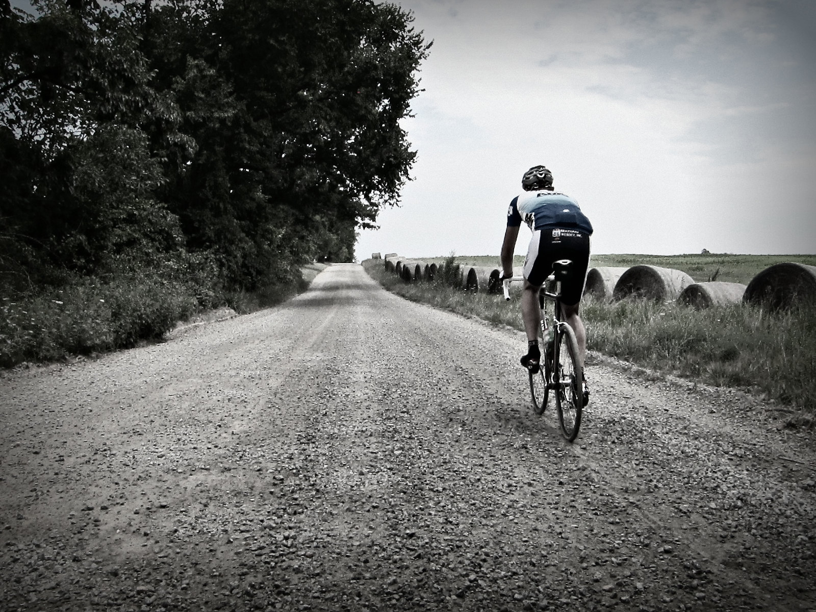
Overview: Loudoun is where it is at for Gravel in the Washington DC Metro Area. There is Gravel everywhere west of Rte 15. There are awesome roads spread throughout the county. The Middleburg area is really nice. Check out the link above for Loudoun Dirt Road Database. It also covers Northern Fauquier County. You can plan your own route if you like or use some of mine.

40 miler This route will take you north to Historic Waterford via one the nicest gravel roads in Loudoun, Old Waterford road. Then it heads west to Round Hill. Before heading back into Leesburg. There is approximately 26.3 miles of gravel roads on this route. The route is 65% gravel 35% pavement with approximately 3100 feet of climbing. There is one water stop at about mile 21.5 in Round Hill. You have to go off course a few hundred yards. Instead of turning Right on Airmont Rd., turn Left on Main St. (or Woodgrove rd.). There is a General Store a block down on the left. Then just turn around and go back to Airmont rd to get back on course.

44 miler North Here is one that will take you north again to Waterford then west to Morrisonville. It will head south along Purcelville road (nice road) with a view of Shot Hill Mountain to your right. Then you will head over to Hamilton before ending in Leesburg. The route has approx. 28.6 miles of gravel roads  The route is 64% gravel and 36% pavement with aprrox. 3600 feet of climbing. There only one water stop on this route. It is the Hamilton Convenience Stop at mile 31.3 in Hamilton.

46 miler South This route heads south towards Middleburg's horse country. It takes you on some must do Loudoun roads. First Oatsland rd, a little climby but very pretty in the spring. Then Carters Farm rd., not long but one the nicest in Loudoun. Then there is Foxcroft rd although it is paved, it is a most do. You will pass by Huntland farm and other nice properties before ending in Leesburg. There is approx. 28.3 miles of gravel roads on this route. 64% gravel and 36% pavement with approx. 3800 feet of climbing. There are 2 water stops on this route. The first is the Safeway grocery store in Middleburg at mile 21.1. Don't fret if you pass this one the next is the Philomont General Store at mile 29.

The Classic 65 Miler I call this the classic because it was the first route I planned for Loudoun County. I have improved on it since but it is still a classic. With about 4700 ft of climbing, it will not hurt too bad. There is approx. 46 miles of Gravel roads with approx 18 miles of pavement. The are 2 water stops. The first is in Round Hill about mile 28.5. The second is a Philomont General Store at mile 49.5. There is one water crossing at Beaver Dam Ford (just before mile 49 on Jeb Stuart road) so plan according if you ride this in the winter. Here is a alternate route that increases the percentage of gravel roads you will ride. It has the same number of water stops. They come at mile 21 in Round Hill and mile 45.6 at Philomont. This route is approximately 64 miles long. It still has the ford you need to cross. Your feet will most likely get wet :). There are 2 water stops on this route. The first is in Round Hill (see 40 miler description). The second is the Philomont General Store at mile 49.5.

Loudoun Gravel Century Like it says, This route is a 100 miler with 76 miles of Gravel roads and just 24 of paved roads. The pavement is so spread out you barely notice it on this ride. A mile here, a 1/4 mile there. You will be either loving it or praying for pavement. This basically takes you all though western Loudoun on some awesome roads. There is approximately 7600 feet of total climbing. Nothing major or long, just a bunch of ups and downs. There are a few water stops but bring as much as you can carry. The first stop is at about mile 17.5. The second is about mile 45. The third and final is at mile 77. Of course you could always bum water from a house along the route. So plan according if you decide to do this on a hot summer day.