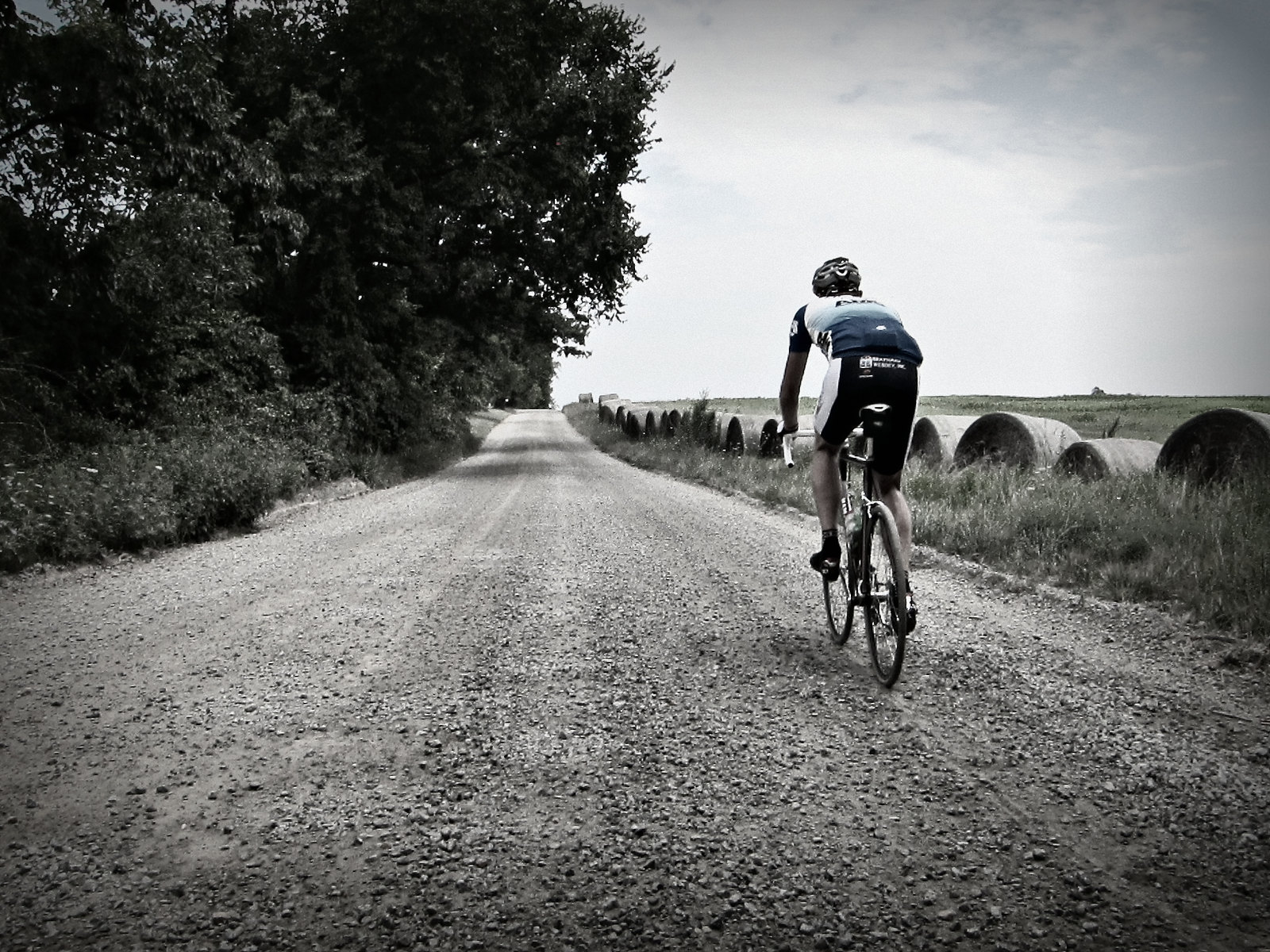
Here are Some Gravel Grinders in Loudoun County,Va. They are 40 to 100 miles long. You can park and start from Loudoun County High School in Leesburg, Va for these routes. Check back here often. Routes will be add regularly.
Overview: Loudoun is where it is at for Gravel in the Washington DC Metro Area. There is Gravel everywhere west of Rte 15. There are awesome roads spread throughout the county. The Middleburg area is really nice. Check out the link above for Loudoun Dirt Road Database. It also covers Northern Fauquier County. You can plan your own route if you like or use some of mine.
40 miler This route will take you north to Historic Waterford via one the nicest gravel roads in Loudoun, Old Waterford road. Then it heads west to Round Hill. Before heading back into Leesburg. There is approximately 26.3 miles of gravel roads on this route. The route is 65% gravel 35% pavement with approximately 3100 feet of climbing. There is one water stop at about mile 21.5 in Round Hill. You have to go off course a few hundred yards. Instead of turning Right on Airmont Rd., turn Left on Main St. (or Woodgrove rd.). There is a General Store a block down on the left. Then just turn around and go back to Airmont rd to get back on course.
44 miler North Here is one that will take you north again to Waterford then west to Morrisonville. It will head south along Purcelville road (nice road) with a view of Shot Hill Mountain to your right. Then you will head over to Hamilton before ending in Leesburg. The route has approx. 28.6 miles of gravel roads The route is 64% gravel and 36% pavement with aprrox. 3600 feet of climbing. There only one water stop on this route. It is the Hamilton Convenience Stop at mile 31.3 in Hamilton.
46 miler South This route heads south towards Middleburg's horse country. It takes you on some must do Loudoun roads. First Oatsland rd, a little climby but very pretty in the spring. Then Carters Farm rd., not long but one the nicest in Loudoun. Then there is Foxcroft rd although it is paved, it is a most do. You will pass by Huntland farm and other nice properties before ending in Leesburg. There is approx. 28.3 miles of gravel roads on this route. 64% gravel and 36% pavement with approx. 3800 feet of climbing. There are 2 water stops on this route. The first is the Safeway grocery store in Middleburg at mile 21.1. Don't fret if you pass this one the next is the Philomont General Store at mile 29.
The Classic 65 Miler I call this the classic because it was the first route I planned for Loudoun County. I have improved on it since but it is still a classic. With about 4700 ft of climbing, it will not hurt too bad. There is approx. 46 miles of Gravel roads with approx 18 miles of pavement. The are 2 water stops. The first is in Round Hill about mile 28.5. The second is a Philomont General Store at mile 49.5. There is one water crossing at Beaver Dam Ford (just before mile 49 on Jeb Stuart road) so plan according if you ride this in the winter. Here is a alternate route that increases the percentage of gravel roads you will ride. It has the same number of water stops. They come at mile 21 in Round Hill and mile 45.6 at Philomont. This route is approximately 64 miles long. It still has the ford you need to cross. Your feet will most likely get wet :). There are 2 water stops on this route. The first is in Round Hill (see 40 miler description). The second is the Philomont General Store at mile 49.5.
Loudoun Gravel Century Like it says, This route is a 100 miler with 76 miles of Gravel roads and just 24 of paved roads. The pavement is so spread out you barely notice it on this ride. A mile here, a 1/4 mile there. You will be either loving it or praying for pavement. This basically takes you all though western Loudoun on some awesome roads. There is approximately 7600 feet of total climbing. Nothing major or long, just a bunch of ups and downs. There are a few water stops but bring as much as you can carry. The first stop is at about mile 17.5. The second is about mile 45. The third and final is at mile 77. Of course you could always bum water from a house along the route. So plan according if you decide to do this on a hot summer day.
Great site! Any chance you can include starting/ parking areas for the rides? I know very little about Loudoun county. I'd like to hit the 44 north on Sunday, but I'm not sure where to park. Thanks again for a great site.
ReplyDeleteWant me to ride your bike for you too?
DeleteAt the top of this post it gives the starting location, Loudoun County High School in Leesburg, Va. I added a google map link to the high school. You park and start from there.
ReplyDeleteThanks. Sorry I missed it.
DeleteWhat tires have you been running on the Loudoun routes? 25-28mm road tires or the larger 30mm gravel tires.
ReplyDelete28 to 32mm. 28's would be perfect if I could find some with side knobs.
ReplyDeleteThanks.....I've used 25mm's on some of the Haymarket roads but saw the new Challenge Almanzo at NAHBS that looks good.
DeleteI did the 46 miler in dry conditions on 25mm gatorskins with no problem. Went with my normal road air pressure (100 lbs), but probably should have lowered it a bit.
DeleteI use Cyclocross speed 35mm, maybe 1 mph slower on pavement but at 80 psi they handle loose and hard pack gravel super nicely.
DeleteJust a random note of thanks! I'm in baltimore, and have been looking for a resource to plan w/e CX training rides. This is perfect! Keep up the awesome work.
ReplyDeleteThanks Dkeg for a great site, will have to do them all this spring.
ReplyDeleteA note on the alt classic route: the right turn at mile 44 on St Lous Rd / 611 is incorrect. It should either be continue straight on 630 Jeb Stuart road or not on the cue sheet at all. Besides that it was a great ride! Thanks for putting the routes together and posting them to share!
ReplyDeleteThanks Lukas, I corrected it.
ReplyDeleteHow did you go about sourcing your routes? I know there is more to be had in Fauquier but was unsure of how to find it without putting boots on the ground. Thanks!
ReplyDeleteHere is a link to a database I am working on for the area. http://goo.gl/maps/fLvxz
ReplyDeleteMost of the roads are not confirmed. I used the VDOT maps. VDOT maps are not up to date. So a lot of what they have that is marked as gravel has been paved. So I check with Google Earth. You can learn what to look for and tell if a road is gravel or paved. This method is not 100% accurate. But it can give you an idea before you go out and ride.
Any way of accessing the database now that google maps has changed?
ReplyDeleteI've been looking for this as well. Hopefully, these incredible maps and extensive information about the gravel roads can be saved and updated.
DeleteA new gravel event based in Leesburg takes place for the first time August 30th, 2015. Info here if you're interested. http://www.artisancyclefest.com/
ReplyDeleteThis comment has been removed by the author.
ReplyDeleteRode the 46 miler yesterday. Beautiful route, lots of fun. Highly recommend.
ReplyDeleteThe 46 mile route is fantastic! I rode it yesterday and enjoyed it very much. Thanks!
ReplyDeleteThanks for sharing these routes and the gravel map! I rode your 65 mile route this weekend as my first real gravel ride - it was a beautiful route, but it was way tougher than I expected! I'm looking forward to trying out some more of your routes!
ReplyDeleteI rode the 40 mile route for the second time a few days ago (first time was July 2017) and I'm not sure if it was my imagination but the roads seemed to have significantly less gravel/rocks. I hope they aren't prepping/gutting the roads to be paved in the near future?
ReplyDeleteWhat SS gearing would you recommend? (By the header photo, I'm guessing there are some who do such things here!)
ReplyDeleteThanks for these routes! An alternative place to park for the routes that go up Old Waterford Road is the parking lot at Ida Lee Park in Leesburg.
ReplyDeleteNice site keep it up
ReplyDeletehttps://www.engineringtechnologyservices.com/2020/08/Bituminous-Road.html
I have a Trek Checkpoint. I run 40mm gravel tires but have another set of wheels with 32 gatorskins. I use them mostly on long rough road rides or road and some gravel mix. Which would you suggest on the 100 miler? Is that much gravel going to be more comfortable with the bigger tires? Thoughts?
ReplyDelete